|
Josef
Quinn Memorial Library
Paramount
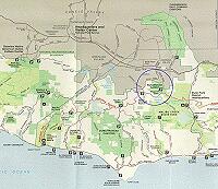
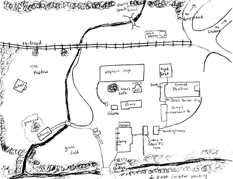
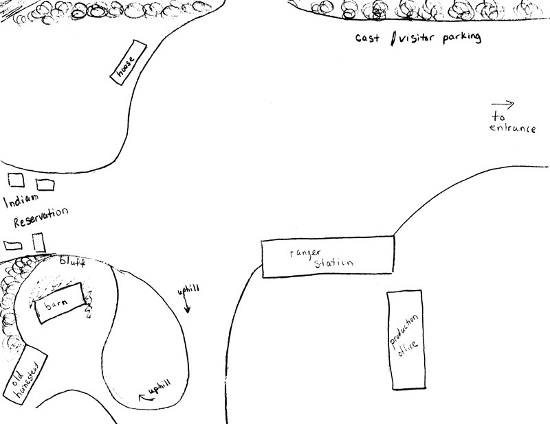
Ranch and Malibu Creek State Park Maps
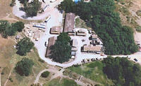 |
|
Western
Town Aerial View
|
For those of you who may venture out to the P-Ranch or to Malibu
Creek State Park, the following maps may come in handy.
Although
the P-Ranch's Western Town is no longer used for Dr. Quinn filming, the Western
Town still exists, and the spirit of Dr. Quinn remains.
Despite
the changes, the framework of the original town is still there,
and you can still find the remnants or the areas where various
buildings from Colorado Springs (c. 1870) were once located.
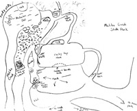
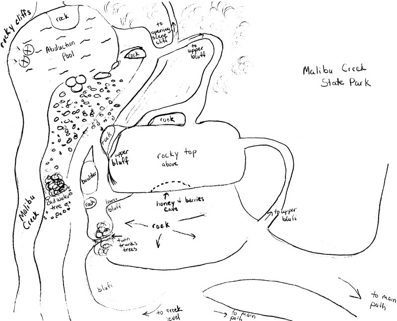
The
maps below are numbered according to how they go together. Map
1 goes on top, with map 2 and 3 joining from the bottoms of
the previous map. Map 4 is a standalone for now, but there may
be other maps of Malibu Creek State Park coming later. You can
view the full size image by clicking on the thumbnail below.
For printing, these maps were scanned at 300dpi but resized
to fit your screen. If you wish to print out a full size, please
contact us.
|
1
- Homestead
|
2
- Main Town
|
3
- Parking Lot
|
4 - Malibu Creek State Park
|
|
1
|
|
|
2
|
| 3 |
 |
 |
4 |
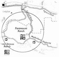 You need to take hwy 405, 134 or whatever else you can take
going north to the Ventura freeway, hwy 101 west. Take hwy 101
west to Kanan Rd. At the stop light turn left and go across
the hwy over-pass. Go straight, through the light (you are still
on Kanan Rd) You need to take hwy 405, 134 or whatever else you can take
going north to the Ventura freeway, hwy 101 west. Take hwy 101
west to Kanan Rd. At the stop light turn left and go across
the hwy over-pass. Go straight, through the light (you are still
on Kanan Rd)
Click
Here for larger view
(Download time 15 sec - 56K)
Cornell
Rd. will be on your left immediately after you cross Agoura
Rd. Turn left and veer to the right. Go down Cornell Raod approx
2.5 miles.
Entrance
is on the right hand side. There is plenty of parking and when
you walk across the bridge, it's Magical!
You
are now in Colorado Springs.
 Directions
from LAX to the Goodnite Inn in Calabasas and from the Inn to
the P-Ranch Directions
from LAX to the Goodnite Inn in Calabasas and from the Inn to
the P-Ranch
When you exit the airport, stay straight on Century Blvd. East
to the 405 North Freeway. Take 405 North to the 101 West Freeway
toward Ventura. Stay on 101 West until you see the Las Virginas
exit. Turn left off the exit ramp back over the freeway. Turn
right onto Agoura Road and the Goodnite Inn will be on your
right.
The beautiful drive to the P-Ranch is very easy from the Goodnite
Inn. Go back to Las Virgenes Road and go right. Continue for
several miles until you come to Mulholland Drive and turn right.
(BTW, going straight will take you through the canyon to the
ocean.) Continue on Mulholland through part of the Malibu State
Park. When you get to the 4-way stop - Cornell Road - take a
right. The entrance to Paramount Ranch will be on your left
just over the first hill. A sign is posted.
Or, you can turn right from the parking lot of the Goodnite
Inn and continue down Agoura Rd. until you intersect with Kanan
Dume Rd. Turn left at the traffic light and take the very next
left onto Cornell Rd. Follow this around and past the homes
until you go around a sharp curve around to the left -- approx.
2.5 miles. The entrance to Paramount Ranch will be on your right.
A sign is posted.
Directions to the 405 Freeway from all rental companies at
LAX
Continue East-bound on Century Blvd. As you approach La Cienega
Blvd move into the *3rd* lane from the right. (The 2 far right
lanes will force you to turn right onto La Cienega toward the
entrance for the Southbound 405 freeway. This is fine if you're
looking to check out the Queen Mary or the volleyball tournaments
in Manhattan Beach, but not if you're aiming for Calabassas/Agoura
Hills.) After crossing La Cienega you want to be in the far
right hand lane. You will pass underneath the 405 overpass bridge
before coming to the on-ramp for Northbound 405. Follow directions
from LAX to Goodnite Inn above.
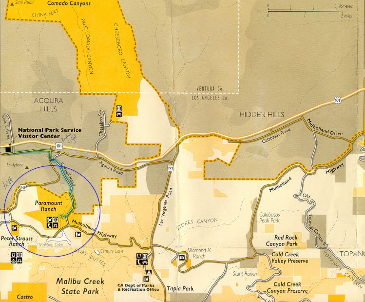
Map
of Agoura Hills
|


